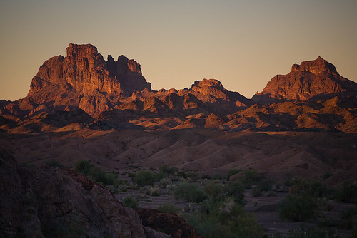
This will be my second season being involved with the Red Cross Canoeing Committee here in Sacramento, and this year some of the core members decided to organize a group paddling trip down 43 miles of the Lower Colorado River starting at Walter's Camp near Blythe and finishing at Squaw Lake.
I have to admit, I was a bit skeptical about paddling the Lower Colorado in Southern California. I grew up in Riverside, which is within a couple of hours of the area, and I made it a point to avoid such places as Blythe which is the nearest town to our put-in. On top of that, it's a pretty major commitment to dedicate a whole week to a trip, not just for me, but for my wife who would be home all alone with our two young kids (7 and 3 years old). Still, I have this unrelenting hunger for adventure, and this trip promised plenty of it, so knowing that I'd owe Jennifer big time (which I'm sure I'll be reminded of for quite some time) I hopped on-board for a journey that did not disappoint in the slightest.
We started our trek from Sacramento to the Lower Colorado by making our way down to Cottonwood Group Campground at Joshua Tree National Park. It was only a short drive off I-10 right on our route to the put-in at Walter's Camp, so it was the perfect stopping point and it gave us a chance at an equipment check prior to setting off down the river. I'm ashamed to say this is the only time I have ever been to Joshua Tree NP. It's an amazing place, and someday I'll devote a whole trip to exploring it.
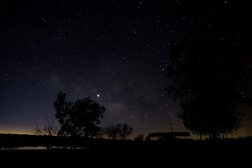
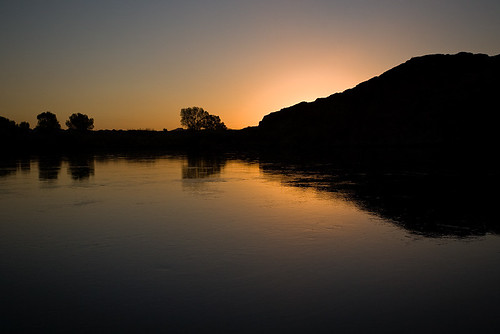
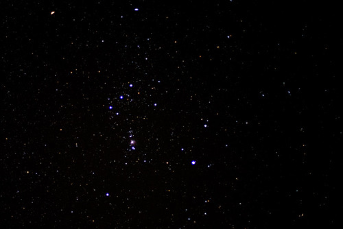
The next morning we made our way over to Walter's Camp after a short stop off in Blythe for some last minute supplies. Robert, the guy that runs the camp and the camp store met us as we pulled up and was a great host for us. Not only was he able to accommodate shuttling our vehicles to our take out at Squaw Lake ($70 per vehicle as of this posting), but he and his wife May also treated us to one hell of a Superbowl Party at the bar in the store (with some of the best fried chicken and other party snacks thrown in for free). We all had a blast. In fact, we probably had too much of a blast as the next morning was quite the struggle to get going. I awoke at 3' in the morning feeling like crap and unable to sleep, but upon getting up to relieve myself I was treated with an amazing array of stars above me. I just had to go back in the tent to retrieve my photo gear (much to the chagrin of Jack who later commented I that I had zipped more zips than any F'er should be allowed in one night). I think Jack later forgave me when he saw the photos I had captured (or perhaps it was the chocolate cake I baked in the dutch oven, but that's for later in the story).
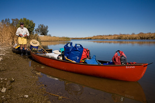
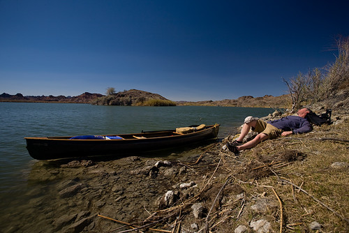
The morning started out in slow motion with nobody seeming to get it into a higher gear. Eventually we had gathered all the gear and the canoes at the water's edge and began our first loading. Most of us were doubtful that we'd be able to load up two truck-fulls of gear into the boats, but to my utter astonishment everything was quickly swallowed up into the belly of our paddling beasts. I'd like to see someone try to pull that off with kayaks :-)

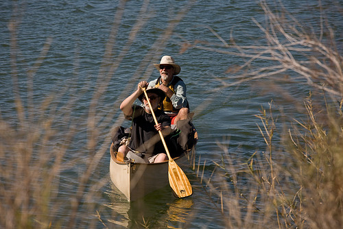
So as it was, we set off down the channel quickly arriving at the confluence with the Colorado River which would carry us down through an epic journey. Patrick and I paddled the 19-foot Wenonah Jensen referred to as the River Hippo(I in the stern since I was slightly less hung over) with Russ and John in the Mad River Explorer, Kurt and Noel in the Dagger Legend (Ruth), and Jack in the Bell Wildfire solo. Some of us were paddling harder than others this morning, but none-the-less we arrived without too much effort at our first stop, Draper's Cabin just south of Draper's Lake.
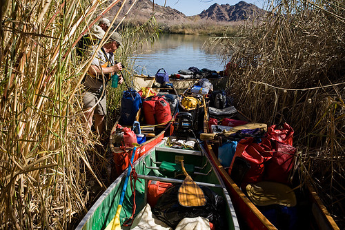
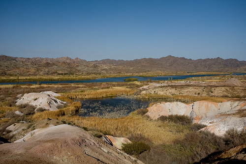
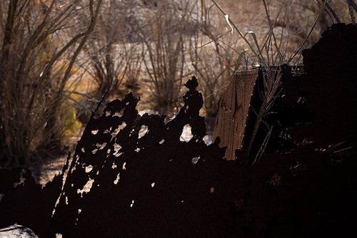
Draper's Cabin was a nice little stop to start the trip. We all agreed that Miner's Cabin further down river had more of an authentic feel to it, but it was still neat to see all the odd stuff (perhaps some original, and some certainly not) and get a feel for what it must have been like to live way out in the middle of nowhere. The view of the river from the hill behind the Cabin is worth the short hike to the top. Since the landing was so narrow we couldn't easily gain access to our food for lunch here, so we paddled a short ways down and across the river to Lighthouse rock for our first meal on the water.

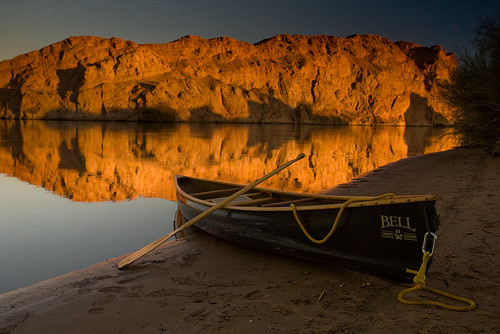
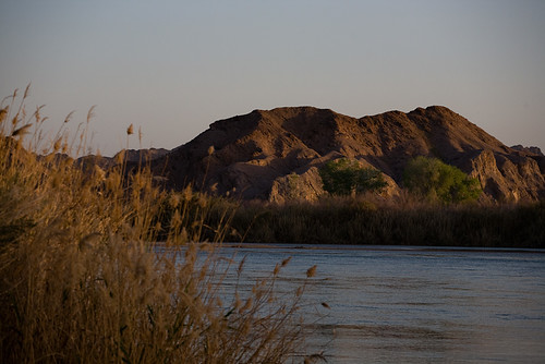
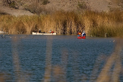
The current on this stretch was moving us at a brisk 2.8 miles per hour with an average paddling speed of 5.3. Even still it was a long first day of paddling with 15 miles to be covered before reaching our campsite. There was some confusion finding 4-S camp as my GPS waypoint appeared way off. I later figured out that the coordinates I had gotten from a Boy Scout troop online was shifted by one site (I had 4-S camp labeled as Outpost camp, Carrizo labeled as 4-S, and so on). We stopped for a bit at Outpost camp as I was feeling a bit ill (ever since I was a kid I periodically get this strange throat constriction that makes me nauseous). By good fortune we decided to push on to 4-S (with Patrick taking over the stern), and we were rewarded by a quite amazing campsite right on the river with a wonderful view of Hoge Rock across the way (see the first photo on this posting above).
We all agreed that 4-S is the prime spot to camp along this stretch of the river. One of the great features of this camp was the new pit toilet system they have there with a solar powered fan that keeps them absolutely non-smelly (works amazingly well!). Though a 4wd road can access the camp, we saw nobody on land or water during our stay here. What about air you say? That's a different story. As I was resting from my illness and my fine camping buddies were unloading and setting up camp (they even set up my tent, what a great bunch of guys!), we heard a helicopter in the distance. Suddenly this Search and Rescue helicopter flew by (perhaps Coast Guard, but I'm not positive), giving us all a wave. They seemed to have flown away after that when suddenly they came in again this time really low doing a partial circle around our camp at an extreme angle all the while smiling and waving. We were hooting and cheering and giving them a big thumbs up for the show. It's good to know there are fine men like that out there to save our butts if we should need them, and it's great to know they like to have some fun just as much as we do.
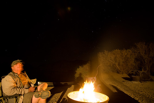
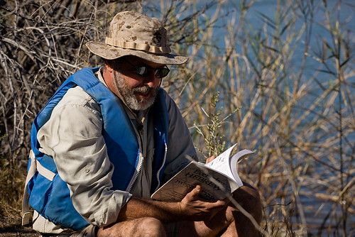
That evening Patrick treated us to an amazing Mexican dinner and John, needing only a few words of instruction baked up a yummy batch of Trader Joe's corn bread in the dutch oven to go with it. The food was great, the spirits were flowing, and the stars were nothing short of amazing this night. Noel gave tours of the night sky through his high powered binoculars while Jack entertained us with some great (and often hilarious) songs with his Baby Taylor guitar. I slept with my rain fly off that night and stared up at the stars as I drifted off to sleep for my first good night's rest of the trip. It really doesn't get much better than this.
The next morning we packed up and headed down the river towards Picacho State Recreation Area. I was in the solo boat for this day and each of us that paddled it agreed that we must find a way to drown Patrick in the river so that we can steal his boat (just kidding Patrick :-). Unfortunately the winds were blowing hard this day, and we even encountered a small section of the river with white caps from the gale. I hung close to the bigger boats and rode out the waves, trying to enjoy my white knuckle adventure. We had planned to enter into the Norton's Landing inlet from down river, but once we saw the entrance to Adobe lake we decided to take our chances through the narrow passageway and dead tree laden lake rather than stay out in the main channel. Let me tell you, I had an absolute blast maneuvering through the twisty passageway and stump filled lake. Unfortunately I had not turned on my GoPro HD camera properly to get this section of the paddle, but I did discover it on our break in Adobe Lake so I got a bit of the dead tree maze and a small section of the reed passageway to Norton's Landing. I'll post those video clips soon.
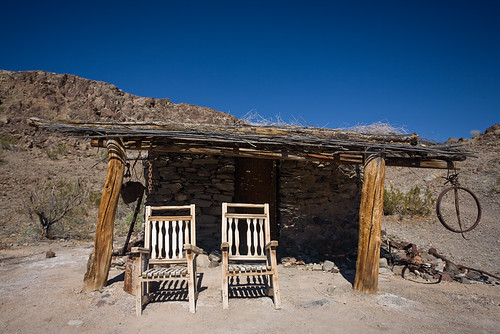
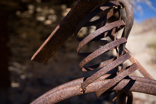
Norton's Landing was an interesting mock mining town. We almost didn't land, as it didn't appear too friendly to those not on a private tour, but we had been told it was a "don't miss stop" by a local who had paddled here often, so we took a quick peak around being very mindful not to disturb anything. It was a bit touristy for my tastes, but the wide array of stuff from old mining artifacts, to rocks, to just antique'y looking things were kind of interesting.
After our short stop at Norton's Landing, we headed down river trying to find the petroglyphs on river left. From my maps and GPS I figured it was just before the first outcropping of rocks that reached the water after the bend in the river down from Norton's Landing. We saw an opening in the reeds, but Patrick made the call that it didn't look navigable for some of our more barge-like canoes. We were bummed to have missed those.

Just down river a mile or so on river right we came across the first of the Picacho Campground docks. There was a slight disagreement of nomenclature as to which of the two docks was the "upper" and "lower". Needless to say, most of us agreed the one up river was the upper and that is where we first landed to investigate our camping options. From the upper dock we hiked in to see the main car camping campground. This is a nice camp complete with solar showers which I hear put out some great hot water even on a February evening (after my freezing shower at Walter's Camp I abstained). The drawback is that it's a good long walk to the campsites (I'd guess half a mile or so), so we hiked over to the boat-in camps at the lower dock (Patrick's upper dock). There are two group canoe camping sites here, and we were told that we really should have gotten a reservation ahead of time. Fortunately neither of them was taken, so we paddled down and set up camp for the night. Even though it was closer than the other campground, it was still a good 150 yard haul to get our voluminous amount of gear up to camp.
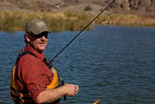
This evening we split up into a few groups with some of us hiking off to see the Stamp Mill, and some fishing down on the river. The hike to the Stamp Mill in the evening light was really beautiful. Being more of a mountain forest dweller for the most part, I don't give the desert enough credit for the subtle beauties it possesses. The last hour of the day really makes those elements shine.
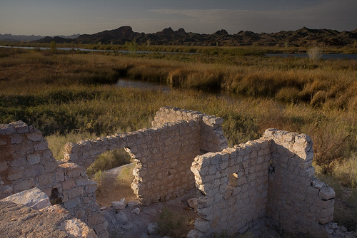
The Stamp Mill was once a large building constructed in the late 1800's of native hand cut rhyolite stone. It's said that at one point 700 men worked here processing ore from the mines, but that it's productivity was greatly exaggerated and the whole operation was built on speculator's investment money. It was a regular dot-com boom of the that time that ended by 1910 and the town supporting it was flooded in 1938 by the installation of the Imperial Dam further down river.
That night we had another fabulous dinner of pasta with sauce complete with sausages and meatballs. There was a great debate between the mixers and the separators of the pasta world, but we compromised by having the separators serve themselves first, while us mixers patiently waited as long as we could for the sauce to penetrate to the core of the noodle bringing pasta perfection. During the preparation I had resumed my dutch oven duties and set out to bake the perfect chocolate cake. I had taken my 12-inch dutch oven aluminum insert, and hand folded it down to the about a 10-inch diameter, placing it in the oven with the cake mix raised on a trivet to get it into the middle of my 14-inch "deep style" dutch oven. After patiently waiting a half hour or so, complete with periodic quarter rotations of the oven counter-clockwise, with a quarter rotation of the lid clock-wise to ensure even heating, it was ready to be taken out. It looked good as I smeared a whole container of chocolate frosting on it, but it would have to wait for some of that massive dinner to digest.
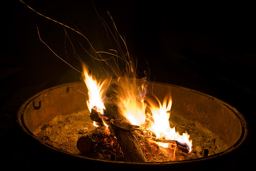
We spent the next half-hour or so smoking cigars around the fire, sipping wine and taking pulls off of flasks filled with scotch and whiskey while Jack played us some good music on the guitar. For some reason I had wanted to look at the maps I had with me, so I got up and headed towards my tent when I came face to face with a raccoon entering the camp. The words of our friendly park ranger who had collected our fees and treated us with some fresh oranges and lemons came to mind. "Watch out for those raccoons at night, they enter camp frequently". No sooner had I smacked my hands and run off this first critter, than I had turned and saw his buddy getting his first taste of chocolate cake. Oh hell no!!! I charge that sucker with intent to maim and ran him off before inspecting the damage done. Luckily I had gotten there just as he had put his paws on it. Two distinct paw marks had marred my camp culinary masterpiece, but nothing else. We took it over to the fire and promptly sliced that bad boy up, careful to serve out the non-coon slices. Let me tell you, that cake was so moist and delicious that Jack helped himself to another serving that the coons had imprinted. Best damn coon cake on the river!
The coons enacted their revenge for missing out on the cake by attempting to tear into the trash cans and our action packers pretty much all night long. Patrick had left a granola bar or two in a bag that fell pray to them, but after Noel had single-handedly fought them off and recovered the bag, nothing further was lost other than the ripped and teared remains of the trash bags coming out of the trash cans about three feet from Russ' tent. The rocks had held though, so the cans remained sealed in the morning though they had been ravaged all night. Keep that in mind while camping here.

On the good side, while packing up in the morning a friendly State Park worker came by and offered to give us a hand with our massive amounts of gear to make up for them having to start work close by with heavy machinery at 6:00 in the morning (didn't wake me, I was already out shooting by then). What a sight it was to see our massive pile of gear swallowed up into this front loader. The fact the we still had a few odds and ends to carry down puts it in perspective just how much stuff one can fit into canoes. I was hesitant to share this, as I don't want to get him in trouble nor do I want every passerby bugging them for a free gear ride, but it just illustrated to me how wonderful the California State Park system is, and how great the people are working for it. Seriously folks, if you live in California vote 'yes' next time the Park System funding initiative comes up. We're very fortunate to have such a treasure in our state.
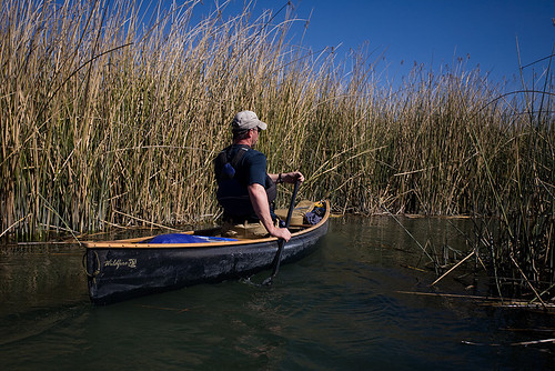
Once loaded up again, we set off for our first stop of the day, Island Lake. This was one of the highlights of the trip for me, navigating through this long maze like passageway in the reeds to a lovely lake. Noel and I landed on a small island in the lake and relaxed and enjoyed the day while others fished, paddled, and explored. What a spectacular way to start the day.

After an hour or two of enjoying the backwaters of Island Lake, we navigated back out to the main channel and headed over to Miner's Cabin and Eureka Mine. This is a great spot to stop and explore the surrounding areas. The cabin is a quaint authentic looking structure (well maintained by the park service), and the area around Eureka mine is great for hiking around and observing the landscape. Russ and Patrick lead a great tour with Russ the biologist giving expert plant identification and Patrick, who used to be an archeologist, giving information about rocks and other interesting features. Being the photographer that I am, I pealed off from the group half way through and took my time backtracking so that I could take in every little detail I found. Below are a few things that caught my eye.

After a delicious lunch of tuna and avocado sandwiches, we paddled the remaining 7 or 8 miles down river to Ferguson Lake for our final night's stay. This paddle felt the hardest for me, as Noel and I were is the Dagger Legend, which I suspect is much more at home in faster moving water than what we were paddling. None-the-less, Ruth got us there in one piece, and we even got to see a bald eagle feasting on a sandbar along the way.

Once at the inlet to Ferguson, we were met head on with civilization. A massive river paddle boat was steaming it's way up river towards us. Noel thought it would be neat to see it go by, so we stopped to watch, but slowly we came to the realization that it was headed straight for us into the lake channel. We turned and high tailed it to trying to get out of this massive ship's way, but it slowly but surely gained ground until it was right on us. Pulling to the side, we all prepared to T-up to the wake. For those unfamiliar with paddling one of the biggest fears paddling a heavily loaded canoe is getting hit broadside with a large wake off a motor boat. T'ing up is turning your boat into the wave so that it has less power to tip you over. Anyways, it was quite the surreal experience after a few days of not seeing much of any other soul to have this massive tourist machine going by with about twenty of those on-board firing away at us with their point-and-shoot cameras. I guess for a short moment we were local celebrities.
After riding out the waves, we made our way through the strong head wind to camp. A couple of friendly folks from Canada were fishing in the spot we had hoped to land at, but after landing elsewhere and hiking over to talk with them they were more than happy to scoot over and allow us to land and set up. Nice people!
We had another wonderful meal of pot roast and biscuits (which I had actually managed to slightly under cook the bottom of them in the dutch oven with the raised platform inside working so well) along with a very good bottle of wine that Noel had brought. Around the fire we did our best to finish off the beer and spirits, with Noel taking a particular interest in the scotch. The music was great, the companionship second to none, and as the fire began to fade it was time to wrap up the last night of our trip.
The next morning we high tailed it over to the Arizona channel hoping to avoid many boat encounters. We got there without incident, and had a great time paddling this channel that none of us had been on before (Patrick and Noel have done this stretch of the river, but through the California Channel at the end). For the most part the way is well marked with buoys, but we did get lost once or twice. The scenery through here was very pleasant and only left about a mile of the main channel to paddle to our take out point at Squaw lake. There was a nasty head wind for the last quarter mile or so across the lake, but we all felt surprisingly strong all the way to the end. It was bitter sweet loading up the gear and canoes. Sad to be closing the final chapter of this adventure, but really starting to get home sick to see my family.
I talked to my 3-year old son on the phone later that day and got all teared up when he asked me if I had found any treasure on the red 'X' on the map. He had seen one of my maps before I left and told me to dig for treasure there. He was so excited about it that it had not left his mind all week. I was a little disappointed to tell him that all I found there was a camp site, but hopefully someday he'll look upon these photographs and read the words that tell a story more valuable than any treasure a pirate can bury. Then he'll know that even in spite of such a wonderful journey, that the treasure I sought most at the end was to see him and the rest of my family that I am truly blessed to have and thankful towards for supporting me in my seemingly never-ending hunger for adventure.
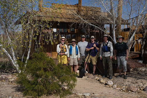
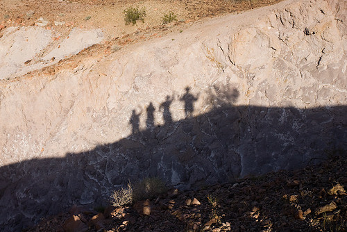
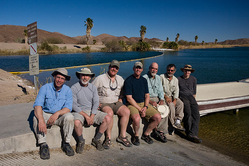
Here's one last shot of the whole gang at the Squaw Lake take out. From left to right Russ, Jack, Kurt, John, Patrick, Noel, and ours truely:
The whole set of trip photos can be found here (I highly suggest clicking the slideshow, but also select "options" and deselect "Embiggen small images to fill screen", otherwise the photos will look like crap as I purposefully upload them small for my copy-right protection):
http://www.flickr.com/photos/januaryphotography/sets/72157626040109578/
GPS Data can be found here: http://www.alwaysjanuary.com/2011/03/lower-colorado-river-canoe-trip-gps.html
Video of the trip can be found here: http://www.alwaysjanuary.com/2011/03/lower-colorado-canoe-trip-video.html
I want to give a special thanks to Norma Miller from the Southern Arizona Paddlers Club for giving us a wealth of information and maps to boot on the area, guiding us to such great points of interest on an amazing trip. The fact that she took so much time to convey so much information touched us all.
5 comments:
Sounds like a wonderful trip. With us here in Canada waiting for the ice to melt, it's neat to think of the places we could be paddling.
Thanks for stopping by Preston. Thinking warm thoughts for you guys in the far north, and looking forward to seeing pictures of that beautiful country when the canoeing season opens up again!
That is a great write up, and the pictures were awesome. I especially liked the stars.
Looks like a fantastic trip. Putting this one in my "must-do" file!!!
Hi! looks like a great trip. My daughter and I were looking for a nice trip suck as this....Any chance you could send my that gpx file? i tried following the link but i wasnt having any luck
Thnks!
Post a Comment